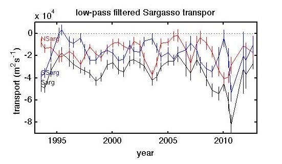
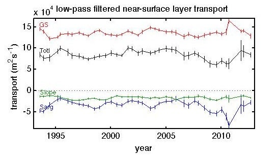
We subdivide the Oleander line into three subregions: the Slope Sea from the continental shelf edge to the Gulf Stream, the Gulf Stream itself, and the Sargasso Sea from the Gulf Stream to Bermuda.
Limits of integration for fluxes:
- Gulf Stream: Set by where the velocity normal to the ship’s track (oriented along 140° and 320°) first goes to zero from either side of the downstream velocity maximum.
- Slope Sea: 39.31°N 72.57°W to the northern limit of the GS.
- Sargasso: southern limit of the GS to 32.78°N 64.89°W
- Northern and Southern Sargasso division: 35.07°N 67.53°W
The Oleander ADCP does not reach to depths that allow for an integration of total transport, the
analyses focus on a single shallow layer, defined as one-meter thick at ~52 m depth.
The mean transports are plotted every six months with a twelve-month window.


Download the data files:
For further information see: Rossby et al. 2005, Rossby et al. 2010

